Pakistan is a country of many rivers, with the Indus River being the most famous. The rivers of Pakistan have been an important part of the country’s history and culture, providing a source of water for irrigation, transportation, and other important activities.
In this blog post, we will explore the various rivers of Pakistan and discover why they are so important to the country. We will look at the physical characteristics of the rivers, as well as their economic and environmental importance. We will also discuss the challenges that the rivers of Pakistan face, and what can be done to protect them for future generations.
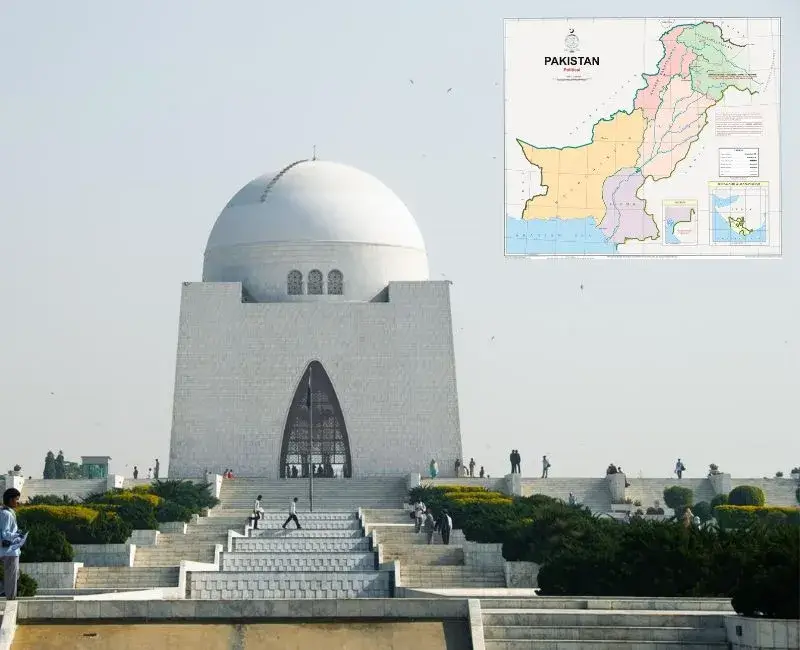
Rivers of Pakistan Map
The Rivers of Pakistan map shows the major rivers of the country, including the Indus, the Chenab, the Jhelum, the Ravi, the Sutlej and the Kabul. These rivers are the lifeline of the country, providing water for agriculture, transportation, and electricity. They also provide recreational opportunities such as fishing and rafting.
The rivers of Pakistan are also known for their diverse wildlife, making them a great place to explore and observe nature. With the help of the Rivers of Pakistan map, visitors can plan their trips to take advantage of the best the rivers have to offer.
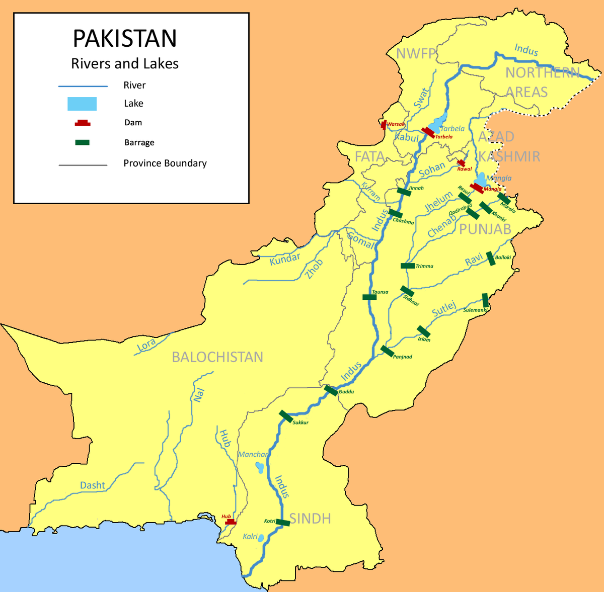
Important Facts About the Rivers of Pakistan
Pakistan is home to five major rivers. They are the Indus, Jhelum, Chenab, Ravi, and Sutlej. All five rivers originate in the Himalayas and flow through the country, eventually emptying into the Arabian Sea.
The Indus River is the longest in Pakistan, spanning over 1,800 miles. It is also the most important river in the country, as it is the main source of irrigation and hydroelectric power. The Indus is the site of the world’s oldest irrigation system, the Indus Valley Civilisation. It is also home to the world’s largest mangrove forest, the Indus Delta. This river is an important part of the culture of Pakistan, and its waters are shared with India and China.
The Jhelum River is the next largest river in Pakistan. It is approximately 725 miles in length and is an important source of irrigation and hydroelectric power. In addition, the Jhelum is an important habitat for fish and other aquatic species.
The Chenab River is an essential part of Pakistan, measuring almost 500 miles in length and being the third largest river in the country.
Indus Water Treaty
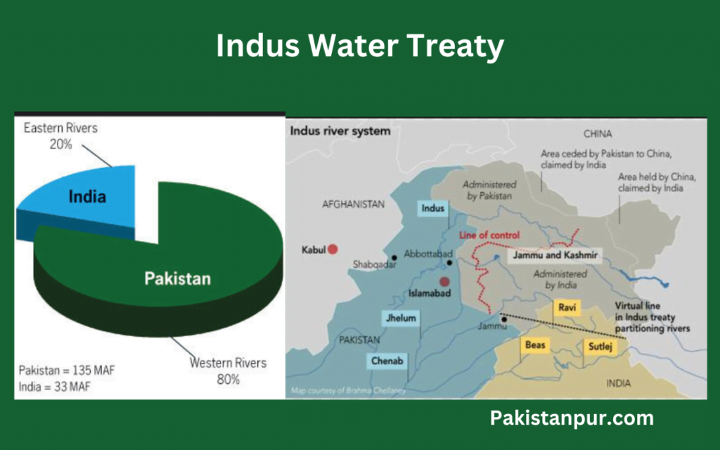
The Indus Water Treaty is an important agreement between India and Pakistan that provides a framework for the equitable use and sharing of the waters of the Indus River Basin.
The Treaty was negotiated and signed in 1960 and has been in force since then, providing a stable framework for water-sharing between the two countries.
The Treaty divides the waters of the Indus River Basin into three main rivers: the western rivers of the Indus, the Jhelum, and the Chenab; the eastern rivers of the Ravi, Beas, and Sutlej; and the shared river of the Indus itself.
The Treaty provides for India to receive 80% of the waters of the eastern rivers and Pakistan to receive the waters of the western rivers. The Treaty also provides for the exchange of data on the flow of water in the rivers, as well as the construction of storage facilities and infrastructure, to regulate the flow of the waters.
Indus River (Sindh River)
The Indus River is one of the most important rivers in Pakistan and is considered the lifeline of the country.
The Indus River is the longest river in Pakistan and the second longest in South Asia. It stretches a total of 2,880 miles, beginning in the Tibetan Plateau in the north and flowing south and west to the Arabian Sea. Along its course, it passes through the mighty Karakoram mountain range and the vast Indus Plain.
It is the source of water for nearly 82 million people, making it the most populated river basin in the world. It is the main source of irrigation for the agricultural lands of Pakistan and its tributaries provide hydropower for the country.
The Indus River is a symbol of the nation’s resilience, as its waters have seen many civilizations come and go, from the ancient Indus Valley civilization to modern-day Pakistan. It has been an important part of Pakistan’s culture and history, playing a crucial role in the development of its society.
From providing water to the citizens to fuelling agricultural growth, the Indus River has been a source of sustenance for the people of Pakistan.
Not only is the river important for its environmental and cultural significance, but it is also an important factor in the nation’s economy. In addition to providing water for agriculture, the Indus River also helps generate hydroelectricity, which is a major source of energy for the country
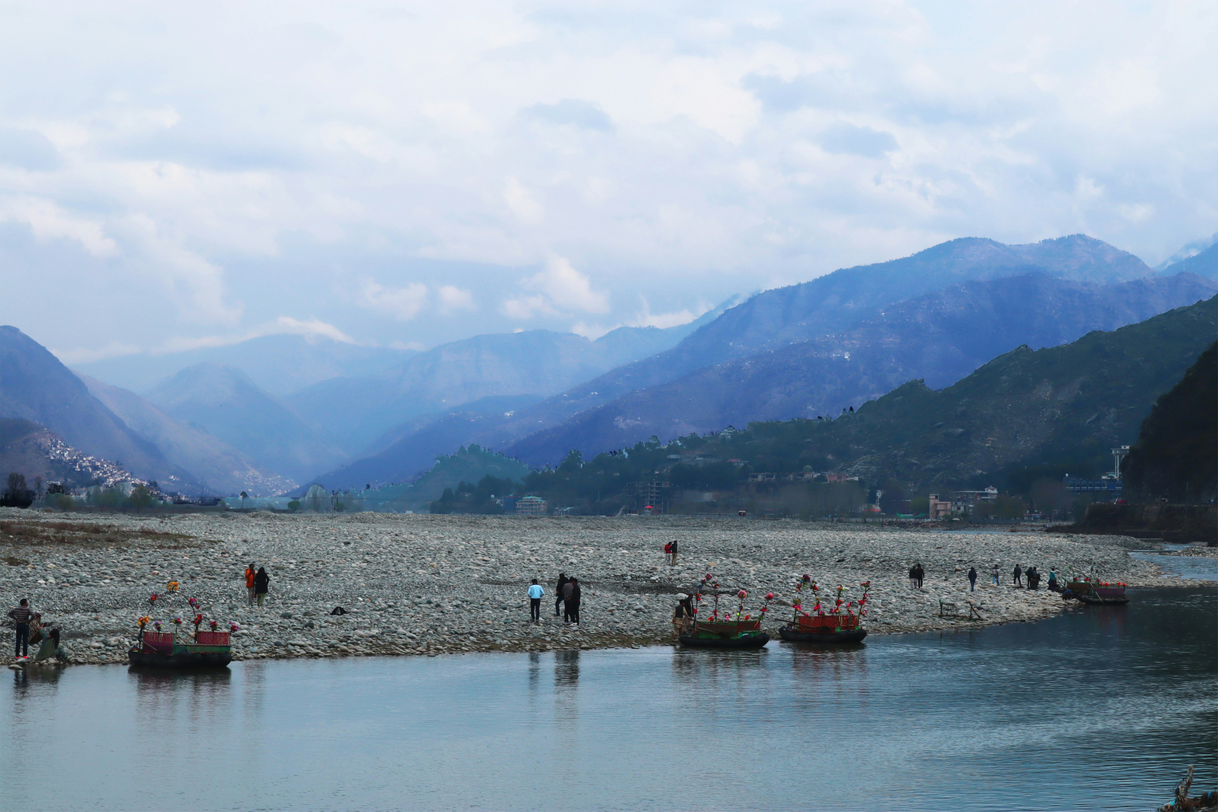
Chenab River
It is a transboundary river that flows through the Himalayas and originates in the Indian state of Himachal Pradesh. The river then flows through the Kashmir region of India and Pakistan before eventually emptying into the Indus River.
The Chenab River is an integral part of the Indus River Basin and is the largest tributary of the Indus. It is known by locals as the ‘Chinab’ or ‘Chenab’, which translates to ‘Moon River’ in the Punjabi language.
The Chenab River is the second longest river in Pakistan, with a total length of 1,114 km (694 mi). It is also one of the most important rivers in the country, providing much-needed water for irrigation and hydropower.

Sutlej River
The Sutlej River is a major river in the Indian subcontinent, stretching across India and Pakistan. Originating from the Tibetan Plateau, the Sutlej flows for 1,450 miles and is the longest river of the Indus River system. The Sutlej River is considered to be the easternmost tributary of the Indus River and is an important source of irrigation and drinking water for both India and Pakistan.
The Sutlej River is used for many purposes, including the generation of hydroelectric power, irrigation, navigation, and fishing. Along its course, the river passes through the states of Himachal Pradesh and Punjab in India before entering Pakistan, where it flows through the province of Punjab and enters into the Indus River at Punjnad near Bahawalpur. The river is also home to many species of fish, birds, and mammals, including the endangered Indus River dolphin.

Ravi River
The Ravi River originates from the Himalayas and flows to the Indus River System. It is the westernmost river of the system, running through the provinces of Punjab, Jammu and Kashmir, and Himachal Pradesh. The total length of the Ravi River is around 720 kilometers, with an average discharge of 1,000 cubic feet per second. The river is an important source of irrigation for the region, supporting a wide variety of agricultural activities.
It is also the main source of water for the cities of Multan and Lahore, both of which are located on the banks of the Ravi River.
The Indus Water Treaty in 1960 has had a devastating effect on the rivers of Pakistan, particularly for the people of Lahore and Multan. During most of the year, the rivers of Ravi, Satluj and Bias are virtually dry, and the only time they see running water is during the monsoon season.

Jhelum River
The Jhelum River is a critically important waterway for the people of Pakistan. It is one of the five rivers that make up the Punjab region, and in fact, its name is derived from the Sanskrit word for “river of life”.
The river is formed by the joining of two main tributaries, the Upper Jhelum and the Lower Jhelum, and it runs for a total of 813 kilometers before emptying into the Chenab River. This river has been an integral part of the region for centuries, and it has been used to irrigate agricultural fields, provide drinking water to locals, and even transport goods.
It is also a popular destination for fishing, boating, and other recreational activities. The Jhelum River is also known for its many religious and cultural sites, such as the shrine of the Sufi saint, Mian Mir, and the ancient city of Taxila, which is a World Heritage Site.

Other Small Rivers and Tributaries
Aside from the major rivers, many other small rivers and tributaries help feed the larger rivers and provide a unique experience.
Gomal River is 400 km long and starts in the eastern part of the country.
Soan River is 250 km long and flows through Punjab.
Swat River is 240 km long and is known for its beautiful valleys.
Kunar River is 480 km long and is the main source of irrigation for the region.
Hingol River is 560 km long and runs through Balochistan.
Gilgit River is 240 km long and runs through the northern part of the country.
Kunhar River is 166 km long and is one of the most beautiful rivers in the region.
Finally, the Dasht River is 430 km long and is an important part of the Indus Basin.
Dams Build by Pakistan After Indus Water Treaty
Pakistan has built several dams since the signing of the Indus Water Treaty in 1960. The most important of these dams is the Tarbela Dam, which has a storage capacity of 11.62 billion cubic meters.
The Mangla Dam is the second-largest dam in the country, with a storage capacity of 6.68 billion cubic meters.
Other important dams are the Warsak Dam, Chashma Barrage, and the Ghazi Barotha Dam.

The numerous dams built by Pakistan since the signing of the Indus Water Treaty have been a major part of the country’s water management strategy. These dams have provided a reliable source of water for drinking, irrigation and power generation, and have also helped to reduce flooding in many areas.


